

Topography: For most of the municipality, the land form falls from a southern watershed, northwards towards the Yarra River, with topographic elevation increasing from west to east. The southern watershed is breached by Mullum-Mullum Creek which bisects the municipality into two major topographic units. The eastern unit is the more topographically varied. Its north-south dissection has produced a sequence of valleys and ridges falling northwards with a supplementary eastwest dissection of valley sides. South of the watershed, the land falls fairly uniformly to Koonung and Mullum-Mullum Creeks. The visual effects of topographic variation are to form micro-landscapes enclosed within valleys, or to reveal panoramic views from ridges and valley sides, across layers of intermediate ridge lines to the northern and eastern horizons.

Watercourses: Watercourses form the principal external boundaries and internal divisions of the municipality. The Yarra River forms the northern and eastern boundary, while Koonung Creek and Mullum-Mullum Creek form the southern. Internal divisions are given by the southern watershed and by Ruffey, Mullum-Mullum and Andersons Creeks. All watercourses contribute to the landscape as definers of topography, as sites for vegetation and as corridors for open space. Physically, the Yarra is significant as a barrier with only three crossings, at Bridge Street (Bulleen), Fitzsimons Lane (Templestowe) and Warrandyte Road (Warrandyte). Visually, the Yarra is unseen for much of its course with contact made between urban areas and the river only at Bridge Street, and Templestowe and Warrandyte townships. The Yarra River is regionally significant for its diverse landscapes, its remnant flora and fauna and its incomplete continuum of public parks and reserves.
Native vegetation: Many old and grand trees remain in the area, some pre-dating white settlement. Relatively little of the native vegetation remains in the western part of the municipality, except along the Yarra River and in some parks. A number of large River Red Gums stand as reminders of the former woodland that would have originally predominated on slopes and ridges of all aspects and along the river flats and drainage lines. All of these large red gums are botanically significant, many have historical associations and most are local landmarks. Several have scars that demonstrate Aboriginal use of these trees as a resource. In the east, a wider range of vegetation communities remain, including Yellow Box woodland on upper slopes with Box Stringybark woodland on more exposed slopes and ridges. Swamp Gum woodland is found along drainage lines, while remnants of Manna Gum riparian forest occurs along major streams.
Old plantings: Exotic trees - those species imported to Australia by white settlers and used as garden and farm plants - create much of the area's landscape character. A number of individual trees form landmarks or provide evidence of past settlements, farms and houses. Monterey Pine and Cypress occur as linear plantings orientated magnetic north-south and east-west, following boundaries of former fields, orchards and house sites. They occur in three main clusters, at Doncaster and Donvale, with a few examples beyond.
Pond systems: A group of approximately 45 ponds or dams occur in North Warrandyte distributed along an east-west belt, north of the MMBW pipe track. Some follow creek lines, but most do not. These ponds are relics and indicators of past agricultural land uses.
Yarra River
The Yarra River forms the boundary of the City to the north. At its western end are the Yarra Valley Metropolitan Park and two municipal reserves, which occupy former farmland.
Vegetation varies from site to site but includes remnant indigenous trees, mature exotic trees from farm plantings, and recent park plantings of indigenous species or exotic decorative species.
The parks have car access and are designed mainly for family, passive recreation with bike paths, picnic areas, barbeques and children's play equipment.
At the eastern reach of the river is Warrandyte State Park which extends upstream well beyond the municipal boundary. Nonetheless, there are large tracts of parkland within the municipality both along the river edge and inland.
Individual park sites vary in facilities provided but share regional and local significance for their scenic, biological and cultural values which include remnant bushland, native animals and birds, access for water sports and former gold mining sites.
Bolin Swamp
Bulleen Road, Bulleen (192.08)
Bolin Swamp contains one of a group of remaining billabongs within the Bulleen and Templestowe area, and one of few along the metropolitan course of the River Yarra. Within the billabong is a fine stand of River Red Gums, individuals of which possibly pre date white settlement.
The remaining vegetation is mainly exotic grasses and Solanum species, with an Elm copse to the south west slope.
Natural drainage is cut off by an embankment at the eastern end of the billabong. The southern bank is undergoing development as a residential subdivision which will be a future source of environmental weeds.
The Bolin Swamp area is of great significance to the Wurundjeri, the Aboriginal group associated with the Melbourne region.
A botanical assessment and management plan are required to safeguard the billabong and Red Gums, and to direct the elimination of environmental weeds and re-establishment of an indigenous vegetation community.
Of State significance for its natural and cultural values.
Westerfolds Park
Fitzsimons Lane, Templestowe (173.47)
The park, which is part of the Yarra Valley Metropolitan Park, occupies a topographical promontory falling northwards to the Yarra River. An "English" style two storey house sits on the high point overlooking the park and river valley with stands of and large individual specimens of River Red Gums and Manna Gums. A deeply incised drainage line bisects the park. Ground cover is mown or rough grass.
Park facilities include car parks, picnic areas and extensive footpaths.
The land which is now Westerfolds Park was originally part of the Unwin Special Survey, and later (1863-1936) a large dairy farm belonging to the Smith family, called "Holyrood Park". Other places associated with this large farming family include "Ben Nevis". In 1973 the parkland was purchased by the State Government for use as public open space(1).
Of regional significance as a metropolitan park and for its remnant indigenous trees.
(1) Doncaster Templestowe Historical Society Newsletter, March 1985.

Yarra River at Porter Street, Templestowe. River Red Gum woodland.
Banksia Park
Templestowe Road, Bulleen (172.12)
A Board of Works regional park planned on North American principles with distributed car parks, shared footways, information signs and interpretation signs, picnic and barbeque facilities, play equipment and sculptures.
The principal landscape images are of pasture and woodland edge. Vegetation consists of some remnant River Red Gums, with plantings of Eucalypts, Acacias and exotic species including Prunus and Pin Oak. Nine interpretive plaques are located along the footway which follows the river course.
Note the old stand of exotic trees adjacent to one memorial including Italian Poplar, Indian Bean Tree, Ash leaf Maple, Common Ash, Alder, Spanish Chestnut & Pussy Willow.
The area was farmed by Sydney Ricardo, a State Member of Parliament. Some rubble footings from his house apparently remain within the grounds of Heide II, and quince and pear trees planted during his ownership are thought to remain within the park (1)
Of local significance.
(1) Maris Taylor, pers. comm.
Birrarung Park
Templestowe Road, Bulleen (172.15)
A metropolitan park designed for family, passive recreation. Park facilities include a linear car park, a foot and bike path circuit and barbeques.
Vegetation consists of remnant River Red Gums along the Yarra bank, plantings of indigenous tree species (mainly Acacias) within the park proper and an understorey of mown or rough exotic grasses.
A degraded horseshoe billabong is lined with willows and has a timer viewing deck.
Replanting is ongoing.
Of regional significance as part of the metropolitan and Yarra Valley park system; and of local significance as a reconstructed, indigenous landscape.
Finns Reserve
Templestowe Road, Lower Templestowe (173.46)
Located between Templestowe Road/Union Street and the Yarra River, the reserve contains a car park, public toilets and play structures.
Most of the park area is under closely mown exotic grasses, with remnant indigenous vegetation (mainly River Red Gums) along the Yarra bank, and single trees or small groups within the body of the park.
Of local significance as a neighbourhood park.
Warrandyte State Park
Warrandyte
State Park comprises the following areas: Jumping Creek Reserve (156.02), Black Flat Reserve (156.01), The Common (176.06), Timber Reserve (175.22), and Whipstick Gully (155.41), and Pound Bend (155.40).
The State Park extends upstream from Pound Bend along the Yarra River and the northern boundary of Wonga Park to include Mount Lofty at its eastern limit.
Within Warrandyte, the park includes Pound Bend and the River frontage upstream to 'The Island'; Black Flat Reserve, Jumping Creek Reserve and the river frontage between; Whipstick Gully; Fourth Hill; Timber Reserve and the Common.
Warrandyte State Park was created in 1975; prior to this the Crown Land reserves that now comprise the Park were separately managed. The early history of the Park is associated with gold mining (see Theme 4 Gold Mining), and later with agriculture and orcharding (see Theme 5 Farming the Land).
The Park contains a number of significant features including remnant indigenous vegetation, native fauna, gold mining relics (including Pound Bend Tunnel, The Island channel, mine shafts and spoil heaps), and evidence of orcharding at Pound Bend.
Landscape quality varies largely in relation to the apparent intactness of indigenous vegetation.
The Warrandyte State Park Management Plan requires the protection of sites of special significance associated with the Aboriginal and European history of the area.
The Park as a whole is of State significance for its biological, visual and cultural values. Some sites within Warrandyte State Park are individually significant for their associations with the discovery of gold, for their extant mining relics and for their biological and visual values.
Bush Remnants
There are few bush remnants in the western parts of the municipality. They are certainly of botanical value, but also have a cultural and landscape value as a remnant of the former natural environment of the area. Bolin Swamp with its stand of Red Gums is listed above as an important remnant of the original Yarra Valley landscape which gives an image of the scene prior to settlement by Europeans, who cleared the land at first for grazing and timber, and later for cultivation.
The attractive setting of the area, combining the features of the Yarra River and open bushland, have contributed to tourist attractions for over a century. Coach trips were organised as early as the 1850s to enable sightseers to watch miners at work and to view the natural beauty (1).
(1) Graham Keogh, The History of Doncaster and Templestowe, 1975, p20.
Zerbes Reserve
Blackburn Road, East Doncaster (194.10)
The Reserve contains a good stand of remnant Eucalypts, probably Eucalyptus cf. nortonii. This is regionally a rare taxon, with the only known comparable stand in the Melbourne region at Greswell Hill, Bundoora (1).
There are also the remains of a Monterey Cypress windbreak consisting of 7 poor specimens, and an extensive mature planting of Monterey Pine, approximately 8 of which were felled in May 1991.
The area farmed by Pickering and later by Zerbe, one of the early German settlers in the area (2).
Of regional botanical significance for its remnant stand of Eucalyptus cf. nortonii. The conifers form a local landmark.
(1) Geoff Carr, pers. comm
(2) Doncaster Templestowe Historical Society.

Zerbes Reserve: Stand of Eucalyptus cf. nortonii
The 100 Acres
Knees Road, Park Orchards (195.05)
A large tract of land with dissected topography and north east facing slopes. It is extensively covered with remnant native woodland, much of which is probably regrowth after clearing.
The area was partly cleared in the early 1900s and the land used to grow berries and fruit trees. Tom Petty's nephew, Jim Mitchell, bought this 100 acre block from Tom, and built a house (since demolished) (1). After proposals to subdivide the area in the 1970s, a community campaign led to its acquisition and management by Council as a bushland reserve.
The Reserve contains at least one Aboriginal site and is likely to contain others.
The relationship of vegetation type to topographical elevation is clearly illustrated, as is a full range of vegetation from canopy to ground cover.
The site requires ecological assessment and the preparation of a management plan for flora and fauna conservation, weed eradication and control, works construction and maintenance, and user education.
Of State significance as an extensive and fairly complete remnant of native woodland within the metropolitan area.
(1) Doncaster Templestowe Historical Society

The 100 Acres: Wild Cherry track
Currawong Bush Park
Reynolds Road, Warrandyte (174.20)
A large tract of land, approximately three quarters the area of "The 100 Acres", occupying a hill top with south, west and north facing slopes, and bounded on the west side by Mullum Mullum Creek.
The reserve contains a visitor information centre, a compound for small kangaroos & wallabies, and a degraded pond.
Remnant woodland demonstrates variations of plant communities with change of topographical elevation and orientation.
Two Aboriginal scarred trees offer an opportunity for public education. (1)
The site is much more degraded than "The 100 Acres". An ecological assessment and management plan are required.
Of regional significance as remnant bushland.
(1) Isabel Ellender, The archaeological survey of Aboriginal sites, report prepared for the City of Doncaster & Templestowe, 1990, p.59.
Tindals Road Reserve.
Tindals Road, Warrandyte (175.02)
A small, fenced section of land carrying relatively undisturbed indigenous vegetation.
A botanical assessment and management plan are required.
Of regional significance as remnant bushland
Municipal Parks
Ruffey Creek Municipal Gardens
King, George & Victoria Sts, Doncaster (193.10)
An extensive park notable for its topographical form of grassed slopes falling to internal creek lines.
Most of the park is covered by closely mown exotic grasses.
Woody vegetation consists of some relic stands of Eucalypt (Box Stringybark), old Monterey Pine windbreaks and a heterogeneous but sparse planting of exotic and native species, some in strangely solitary geometrical groups. This is a park awaiting a design.
South of Cricklewood Drive, an artificial cliff is formed by the work face of a former stone quarry. As well as having picturesque qualities, the quarry face shows the area's geological structure. There are two former quarries within the gardens, and they. were worked until the 1940s.
The eastern section of the park (east of Church Road) was within the property of the early German settlers, the Thieles’ who called the area “Waldau”, meaning “a clearing in the forest”. The homestead “Friedensruh” remains today in Waldau Court (see Theme 5.02), and a pear tree from Thiele's orchard remains within the gardens (see Theme 1.05).
Of local significance, primarily for its historical associations with the Waldau settlement and Thiele family.
Domeney Reserve Extension
Knees Road, Park Orchards (195.13)
A local park with play equipment and a barbe-que occupying the crown of a hill.
The area was worked as an orchard,·owned by Taylor and Sharpe (timber merchants), and operated under the management of Domeney.
Vegetation consists of close mown grass under remnants of native woodland - species including Red Box and Cherry Ballart - with a few Monterey Pines and some planted Australian native species.
Of local significance for its remaining indigenous vegetation, containing seven of the eleven Eucalypt species originally found between Melbourne and the Dandenongs. (1)
(1) Listing citation, Register of the National Estate

Ruffey Creek Municipal Gardens: internal view looking north-eastwards across Ruffey Creek.
Historic Planted Landscapes
As well as individual buildings, sites and features, there are areas or landscapes within the municipality that evoke memories of earlier land uses. Most of these landscapes are distinguished by their plantings, rather than by buildings.
Landscapes dominated by conifers, especially in the form of windbreaks, were once common throughout much of the municipality. Today these remnants of earlier land uses are quickly disappearing.
One major cluster of conifer plantings is in Doncaster, north from George Street to the Yarra, contained between Williamsons Road, Fitzsimons Lane and Blackburn Road.
Typically, plantings line roadsides or are incorporated into residential subdivisions, marking lot boundaries. Often, such plantings are now fragmented, presumably through clearance of individual trees from private gardens.
Two smaller clusters occur in Donvale. One is largely north of the junction of Springvale and Mitcham Roads, where apart from plantings lining Springvale Road, most follow internal boundaries of residential subdivision. A second cluster is west of Glenvale Road. Its outstanding feature was an almost compete rectangular planting at what is now the northern end of Warner Court.
Such plantings are relics of former agricultural land use and delineators of that land use pattern.
Visually, they are the defining element of a local, "Conifer" landscape character.
Plantings will gradually be lost through clearance for road reconstruction (such as Springvale Road south), clearance for residential subdivision, removal for replanting of private gardens, and the senescence of individual trees.

Patterns Old Conifers - Doncaster
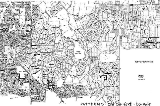
Patterns Old Conifers - Donvale
Avenue of Honour
Blackburn Road, East Doncaster (194.29)
A single line of 13 Southern Mahogany Gums which are the remnant of a World War I Memorial Avenue, planted in 1921 or 22. The Memorial plates are said to be stored under Doncaster Primary School (1).
All of the trees have been badly pollarded and require tree surgery to restore their form. They are proposed to be removed when the adjoining section of Blackbum Road is reconstructed as a 6-lane dual carriageway.
Of local significance as a remnant of a War Memorial, typically planted after World War I at the approaches to Victorian country towns, celebrating each fallen soldier with a Tree of Life'.
(1) Irvine Green, pers. comm.
Bridge Street landscape
22-40 Bridge Street, Bulleen (172.04)
A remnant windbreak planting of Monterey Cypress & Monterey Pine along Bridge Street and Templestowe Road. Located on a topographical high point above the river flats.
"White Oaks" is a single-storey, double fronted, timber, Californian Bungalow with a terracotta tile roof.
The plantings and the group of Edwardian houses enclosed within, form a cultural land scape and create a link with the parkland along the Yarra River and with the garden trees from Heide I and II in Templestowe Road.
The stand forms a strong local landmark and accidental gateway composition with the Red Gum at the junction of Bridge Street and Manningham Road.
Of local significance as a landscape feature.
"Journey's End" is of individual significance (see Theme 7.05 Houses)
Roadside Cypresses
High Street (between Jean St & Mac Robertson St), Lower Templestowe (173.30)
An incomplete 'avenue' of trees in private gardens. On the west side, some trees are clipped to form a hedge, while others are seriously disfigured by cutting of clearance for SEC services. Future road reconstruction will require removal of overhanging branches.
Of local interest. These trees are endangered by future roadworks.
McDonald Avenue
McDonald Avenue, Templestowe (174.17)
A unique street notable for its incorporation of an existing linear planting of Monterey Pines and Cypresses as street trees, and its narrow kerbless road pavement aligned to avoid individual trees.
Of local significance as a unique street form.
Springvale Road Donvale
between Old Warrandyte Rd & Mitcham Rd, Donvale (214.16)
An undulating two lane roadway with gravel verges, lined with mature Monterey Pine and Cypress.
The combination of narrow road, topography and mature conifers produces a uniquely majestic and rural scene.
Although the conifer plantings are not continuous, many trees have good form and size giving the visual effect of a verdant canyon.
Of local significance as the best remaining example of a conifer roadside planting in the municipality.
Pine Ridge
Pine Ridge, Donvale (214.15)
Sloping topography falling eastwards. A triangular street circuit with house lots to its centre and perimeter. Some small timber houses from the 1950s/60s. Other sites have new houses. At least one site is still vacant.
The landscape character is given by the woodland canopy of large mature Monterey Pines, which extend beyond the immediate vicinity of Pine Ridge.
With redevelopment of individual sites, Pines are being removed and replaced with deciduous exotic species, as seems to have happened at Wembley Gardens.
Of local significance for its Pine woodland character.

Pine Ridge
Lutheran Cemetery Area
(Pioneer Memorial Gardens and Schramm's Cottage) Victoria St., Doncaster (193.09)
A collection of relocated buildings set within a recent exotic garden
The site is located on high ground with a west facing slope overlooking the Ruffey Creek Valley.
It is bordered by a windbreak planting of Monterey Pines, which because of their topographical location form a strong, local landmark.
The Lutheran cemetery occupies the western sector of the site. When the Lutherans built their first church here in 1858 Baron von Mueller (who laid out Melbourne Botanical Gardens) sent them a gift of Cypress Pines and other seedlings (1) The Lutheran Cemetery is included in Theme 6.08 Cemeteries.
Of local significance as a landmark pine landscape; of local significance as an historic site.
(1) Graham Keogh, The History of Doncaster and Templestowe, 1975, p20
Landmark Trees
River Red Gum
Service Station, cnr Bridge St & Manningharn Road, Bulleen (172.10)
A very large remnant River Red Gum (Eucalyptus camaldulensis) forming a local landmark. Estimated to be more than 300 years old (1)
Of regional botanical significance, and of local significance as a landmark.
(1) National Trust of Australia (Victoria) file
English Oak
Doncaster Road (east side), near junction with High Street, Doncaster (212.03)
A large specimen tree (Quercus robur) isolated in the footpath with a canopy spread of approximately 12 metres. This tree was apparently planted by John Smedley who arrived in the locality in 1860; it was one of a row of trees.
Of local significance as a landmark.
River Red Gums
Lot 2 Fitzsimons Lane, Templestowe (173.41)
Originally seven trees (Eucalyptus carnaldulensis) were recorded on the National Trust's Register of Significant Trees of Victoria and described as "... a fine example of the open woodland which once covered much of the area ..." (1)
Two very large River Red Gums form a dominant landmark by virtue of their size and topographical location on a slight rise before the junction with Porter Street.
The tree by the roadside will probably be detrimentally affected by current road widening.
Of State botanical significance and local significance as a landmark.
(1) National Trust of Australia (Victoria) file.

River Red Gums, Lot 2 Fitzsimons Lane
Group of Elms and Pines
Cnr Kandanga Grove · and Egan Drive, Bulleen (192.06)
A line of 8 English Elms (Ulmus procera) and 7 Canary Island Pines (Pinus canariensis) and 2 Monterey Pines, extending for approximately 400 metres along Balwyn Road into Yarralea Reserve.
Of local interest as a former rural planting within a 1950s residential area.
River Red Gums
outside Teese's Nursery, Porter Street, Templestowe (173.42)
A remnant stand of eight large River Red Gums (E. camaldulensis) and one mature Swamp Gum (E. ovata) which are obviously companions to the Red Gums in Fitzsimons Lane.
Of State botanical significance and of local significance as a landmark.
English Oak
Cnr Russell & Mullens Rds. Warrandyte (155.43)
An old and once large oak tree (Quercus robur) originally within a private garden, with extensive die-back on upper limbs. The embankment cutting along Warrandyte Road severed and exposed major roots some years ago. This tree is a local landmark with, probably, a reduced life expectancy due to the damage to its root system.
Of local significance as a landmark.
River Red Gum
Templestowe High School, on north side of playing field (192.07)
A large remnant River Red Gum (Eucalyptus camaldulensis) with a canopy spread of approximately 17 metres, and apparently in good health.
The Yellow Box (Eucalyptus Melliodora) located between Hazel Drive and SE corner of oval is also noted.
The River Red Gum is of regional botanical significance, and the Yellow Box is of local botanical significance.
River Red Gums - group of trees
Templestowe Road, Templestowe (172.14)
A group of remnant River Red Gums straddles Templestowe Road in the vicinity of Fran Court.
Two large specimen trees are on the north side of Templestowe Road opposite Fran Court. A third is at the top of the southern roadside embankment, also opposite Fran Court and forms a group with the garden planting of 232 Greenslopes Drive.
Other large Red Gums occur along the embankment top, east of Fran Court and in the gully beside Bimbadeen Park.
The trees are valuable as –
- individual specimens.
- a group which defines local landscape character.
- remnants of former Red Gum woodland. seed sources.
These trees are of regional botanical significance, and of local landscape value. (1)
(1) Tree on south side rejected for Register of Significant Trees
Black Achan Pear
Doncaster Municipal Gardens, Victoria Street (downhill from the toilet block), Doncaster, (193.29)
This tree (Pyrus communis) has extensive dieback, structural and insect damage. A steel cable stay is installed between two limbs, one of which was recently broken above the cable anchor point.
The tree was originally part of Johann Gottlieb Thiele's orchard which he established in 1854-55 soon after building Friedensruh in 1853. (1)
It has declined severely in recent years, and is unlikely to survive much longer. Cuttings for propagation of replacements should be taken immediately.
Of local significance as the only tree remaining from Thiele's original orchard.
(1) National Trust of Australia (Victoria) file.
Bunya Bunya Pine
Cnr Waldau Crt & Victoria St. Doncaster (193.15)
A large well formed and intact specimen Bunya Bunya Pine (Araucaria Bidwillii).
Because of its maturity and location in the garden of a recent house, the tree is probably a remnant of an old garden, probably associated with "Friedensruh".
Of local interest as a landmark.
Pin Oak
"Friedensruh", Waldau Crt, Doncaster (193.14)
A magnificent single mature specimen tree (Quercus palustris) which is uncommonly large for Melbourne, being about 18 metres high.
It was apparently planted in 1910 (1)
Of regional significance for its association with "Friedensruh", as an important element within the Fridensruh garden and for its unusual size. (2)
(1) National Trust of Australia (Victoria) file.
(2) Rejected for Register of Significant Trees
Deodara Cedar
"Friedensruh",WaldauCrt,, Doncaster (193.14)
A large multi-stemmed specimen tree (Cedrus deodara) planted about 1853 by Johann Gottlieb Thiele, the great grandfather of the present owner of Friedensruh. The specimen is believed to have been a gift from Baron von Mueller.(1)
The tree is approximately 16.5 metres high, with a canopy spread of 19 m and a circumference of 4.5 m (at 1 m above ground). (2)
Of local significance for its association with Friedensruh, as an important element within the Friedensruh garden and for its unusual size.
(1) National Trust of Australia (Victoria) file
(2) National Trust of Australia (Victoria) file

Deodara Cedar: Friedensruh
Black Mulberry
Friedensruh, Waldau Crt, Doncaster (193.14)A mature old tree (Morns nigra), with a canopy spread of approximately 10 metres, with extensive structural and insect damage to lower limbs, supplemented by rot from pruning amputations.
This tree was planted soon after J. G. Thiele built "Friedensruh" in 1853. (1)
Of local significance for its association with Friedensruh and Thiele, and as an important element within the Friedensruh garden.
(1) National Trust of Australia (Victoria) file
Oak trees
"Three Oaks", 77 Yarra Street, Warrandyte (155.51)
Two large spreading Oaks in the rear garden of "Three Oaks". From their form, they appear to be English Oaks (Quercus robur).
After the 1939 "Black Friday" bushfires the Presbyterian congregation held church services in a loaned marquee under one of these large oaks at Hussey's home. (1)
Of local interest for landscape value and historical interest.
(1) Bruce Bence, The Mechanics Institute Warrandyte 1882-1990, p.17.
Cherry Plum trees
Yarra Street, Warrandyte (155.52)
A linear planting running eastwards from the river bridge, of old plum trees (Prunus cerasifera) along the upper edge of the roadside embankment.
A feature of Warrandyte for many years, and claimed to date from the gold mining period. While locally valued, these trees need active management to ensure they do not spread into adjoining bushland or become an environmental weed source in this riverside location.
Of local significance as a feature of Warrandyte township and of social value for their reputed associations with the gold mining history of Warrandyte.
"The Diary Tree"
Yarra Street (opposite State Bank), Warrandyte (155.37)
A large multi-stemmed Monterey Cypress (Cupressus macrocarpa) with extensive die back.
The tree is believed to be at least 100 years old, and is visible in early photographs of the street. A letterbox for receipt of notes for inclusion in the community newsletter, lead to the name "The Diary Tree".
Of local significance as a community land mark in the township, but in poor condition due to the effects of road widening, car parking and a Telecom trench which severed major roots. Propagation of replacements from cuttings will be the only long-term means of continuing its genetic life.

Diary Tree: Yarra Street, Warrandyte
English Elms
Yarra Street, Warrandyte (155.53) Opposite the community centre
A copse of English Elms (Ulmus procera) approximately 60 metres long by up to 12 metres wide occupying the roadside embankment, apparently suckering from one or two parent trees. These trees require active management to avoid further spreading and invasion of the indigenous vegetation.
Of local interest as an element of the Warrandyte township.
Source: City of Doncaster and Templestowe Heritage Study (Context Pty Ltd, Peterson R & Stafford B, 1991). p. 1-4 http://www.manningham.vic.gov.au/file/26126/download
Thanks to Carolyn Screen for formatting and proof reading.
No comments:
Post a Comment